- Philadelphia and Southeastern PA: Heatwaves, Severe Storms, Flash Floods, Flash Droughts, Extreme Winds, Microbursts, Tornadoes
- Barrier-Islands From the Jersey Shore to the Outer Banks
- The I-95 Corridor: Severe Storms, an Expanding “Tornado Alley,” Straight-Line Winds, and the Urban Heat Island
- Pennsylvania: When the Levee Breaks — Crying Won’t Help You, Praying Won’t Do You No Good
- Chester County, It’s Shocking: Lightning Strikes Are Surging
- Chester County: Rapid-Fire, Near-Continuous Cloud-to-Cloud Lightning
- West Chester, Pennsylvania: Urban Flooding — Unfortunately, Worms Can’t Swim
- West Chester, Pennsylvania: Hydroclimatic Whiplash and Flash Droughts — Unfortunately, Millipedes Can’t Swim
- The Backyard Experiments: Hydroclimatic Whiplash, Soil Degradation, Insect Decline, and Ecosystem Collapse
- Coatesville, PA: Hydroclimatic Whiplash — Dying of Thirst in a Flood
- Backyard Megapitfall Traps: A Changing Ecosystem for Frogs, Spiders, and Worms
- The Jersey Shore and Florida Coast: Sea Level Rise, Inverse Barometer Effect, Wind Stress, Flooding, Saltwater Intrusion
Archives
bookmark_border$13 Billion Nor’easter Hits Jersey Shore
Where Did the Hurricane Energy Go?
The 2026 Atlantic hurricane season is incredibly rare and historic, but for a surprising reason: it is tracking at a record-breaking low for activity. Despite the destructive flooding along the East Coast, not a single hurricane has formed in the Atlantic basin. While the coast is currently being battered by a powerful nor’easter, the system is an extra-tropical winter-style storm, not a tropical hurricane.
September 23, 2026
The Jersey Shore experiment
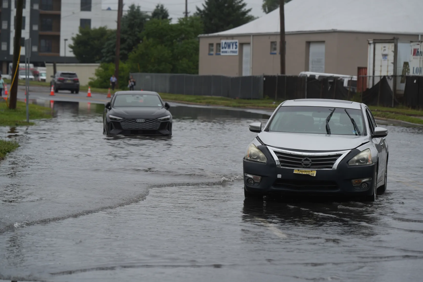
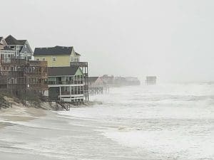
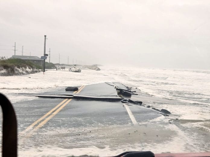
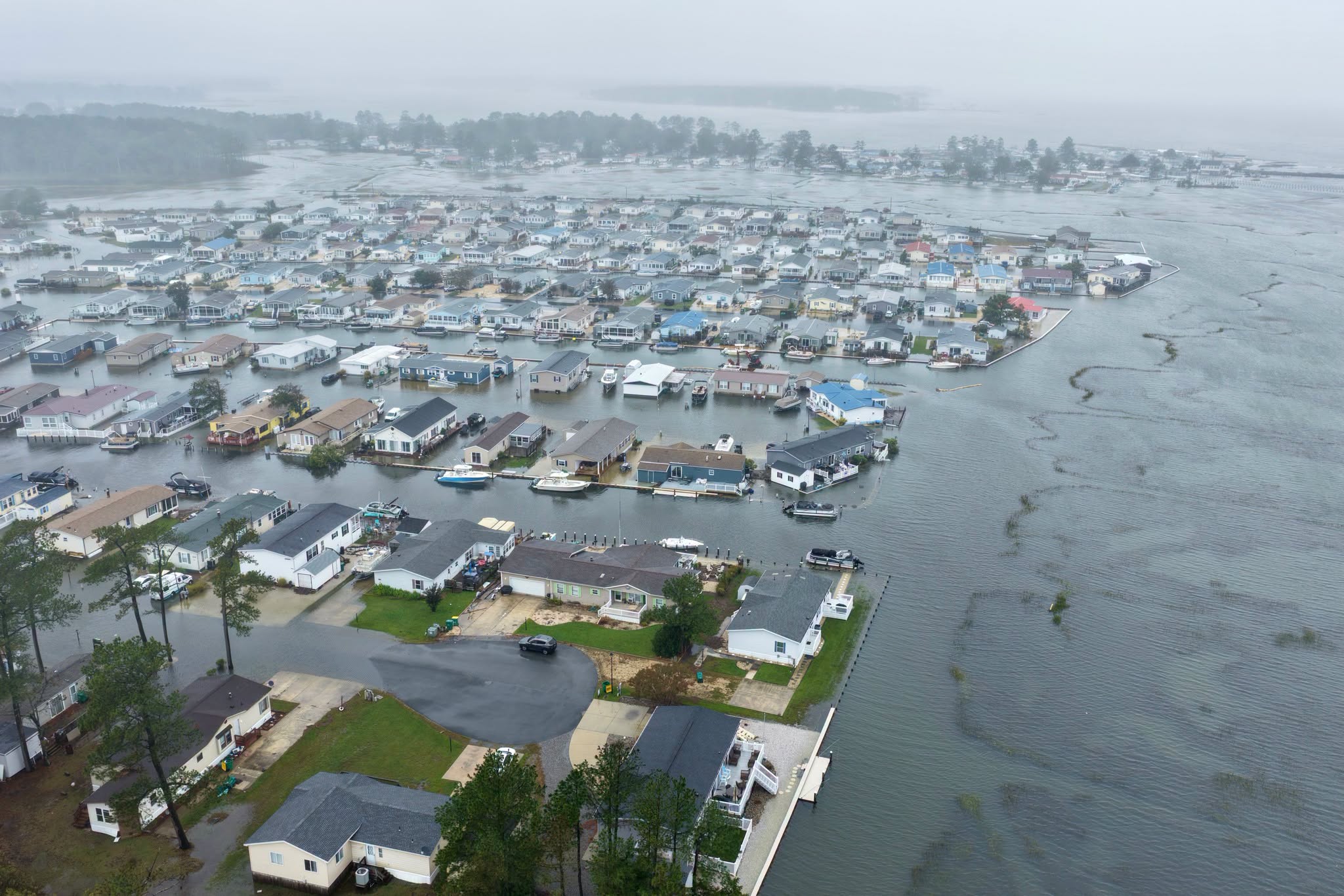
A powerful and exceptionally persistent September nor’easter is affecting the Jersey Shore, bringing coastal flooding, dangerous surf, strong northeast winds, and significant beach erosion. The National Weather Service has extended the Coastal Flood Warning for Ocean, Atlantic, Cape May, and southeastern Burlington counties through Sunday, September 27. The warning calls for one to two feet of inundation above ground level in vulnerable low-lying areas near shorelines and tidal waterways, with widespread roadway flooding possible.
This is shaping up to be one of the most persistent nor’easters in modern history, with significant coastal impacts continuing for days rather than hours. The prolonged onshore winds are repeatedly pushing water toward the coast, while high surf and wave action continue to pound beaches and barrier islands.
The combination of persistent winds, elevated water levels, astronomical tides, and repeated wave attack makes this much more than a single coastal storm event. It is an extended assault on an already vulnerable coastline.
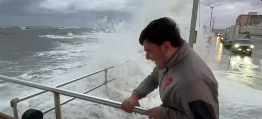
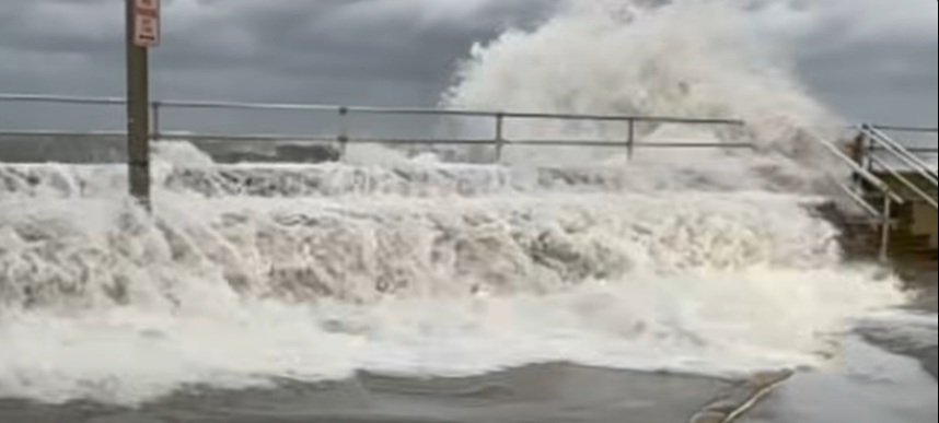
Along portions of the coast, the National Weather Service is also warning of high surf, with breaking waves reaching approximately nine feet in the surf zone.
The timing is important. The storm is occurring during the full-moon period, when astronomical tides can increase the baseline water level and make coastal flooding more consequential.
So here is the experiment: watch and determine the cost.
September 29, 2026
The late-September 2026 nor’easter turned atmospheric and oceanic energy into a massive economic event.
$10–13 BILLION in estimated damage and economic losses.
Flooding.
Beach and dune erosion.
Downed trees.
Power outages.
Infrastructure damage.
Transportation disruption.
The storm demonstrates a simple connection:
STORM ENERGY → FLOODING + EROSION + WIND → DAMAGE → ECONOMIC LOSS
Climate energy does not remain an abstract number measured in joules.
It reaches us through the places where we live, the infrastructure we depend upon, and the economic systems that connect us.
The Jersey Shore: Erosion, Flooding and Infrastructure Damage
The most concentrated physical damage occurred along exposed coastal communities.
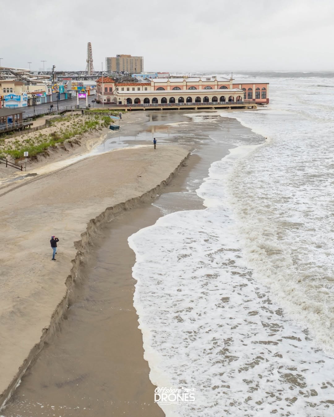
Atlantic City
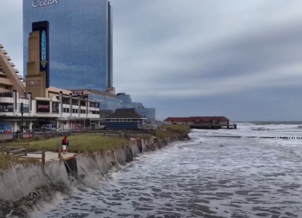
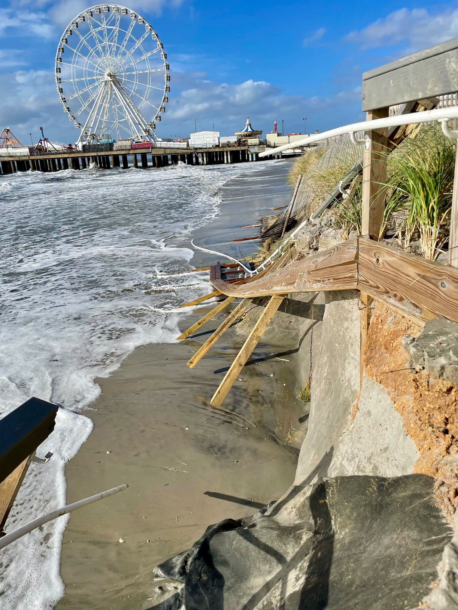
Atlantic City experienced some of its most severe beach erosion since Superstorm Sandy in 2012. A particularly hard-hit area extended for approximately a half-mile north of Steel Pier.
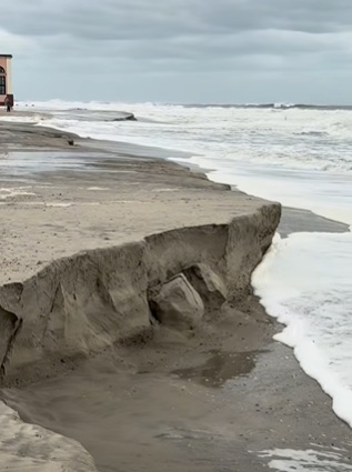
The storm carved deeply into the dunes, leaving steep sand escarpments and exposing previously buried structures. Atlantic City Beach Patrol officials reported that roughly half of the dunes remained in the affected area after the storm.
This is more than a cosmetic change to the beach. Dunes function as part of the coastal defense system. Removing large quantities of sand reduces the physical buffer between ocean waves and developed areas.
Brigantine
Brigantine also suffered extensive beach and dune erosion. City officials estimated that hundreds of feet of beach were washed away, while approximately 30 feet of dunes were lost in one particularly vulnerable area. Officials said the damage could amount to tens of millions of dollars.
The storm also damaged the city’s promenade. A newly installed beach-access ramp was torn from its foundation and carried approximately 30 blocks down the beach before being recovered. Sections of promenade railing were also damaged.
Mayor Vince Sera described the storm as producing exceptionally powerful ocean conditions, while city officials emphasized that the promenade and seawall helped protect homes and infrastructure from even greater damage.
Repeated Tidal Flooding
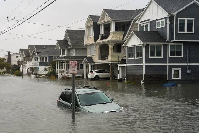
The storm’s slow movement and persistent onshore winds produced flooding over multiple high-tide cycles.
In Sea Bright, New Jersey, for example, successive tides repeatedly flooded neighborhoods rather than producing a single isolated flooding event. More than four inches of rain also fell in portions of New Jersey, adding freshwater runoff to the coastal flooding problem.
The combination of heavy rainfall + elevated ocean water + high tides + strong onshore winds created a compound flooding event.
How Is the Climate Energy Hitting You?
The $13 Billion Northeastern U.S. Nor’easter

Atmospheric and oceanic energy → extreme weather → physical impacts → infrastructure damage → economic losses
bookmark_borderHow Is the Climate Energy Hitting You? Chester County, It’s Shocking
How is a warmer and increasingly moisture-loaded atmosphere changing the conditions under which severe thunderstorms develop?
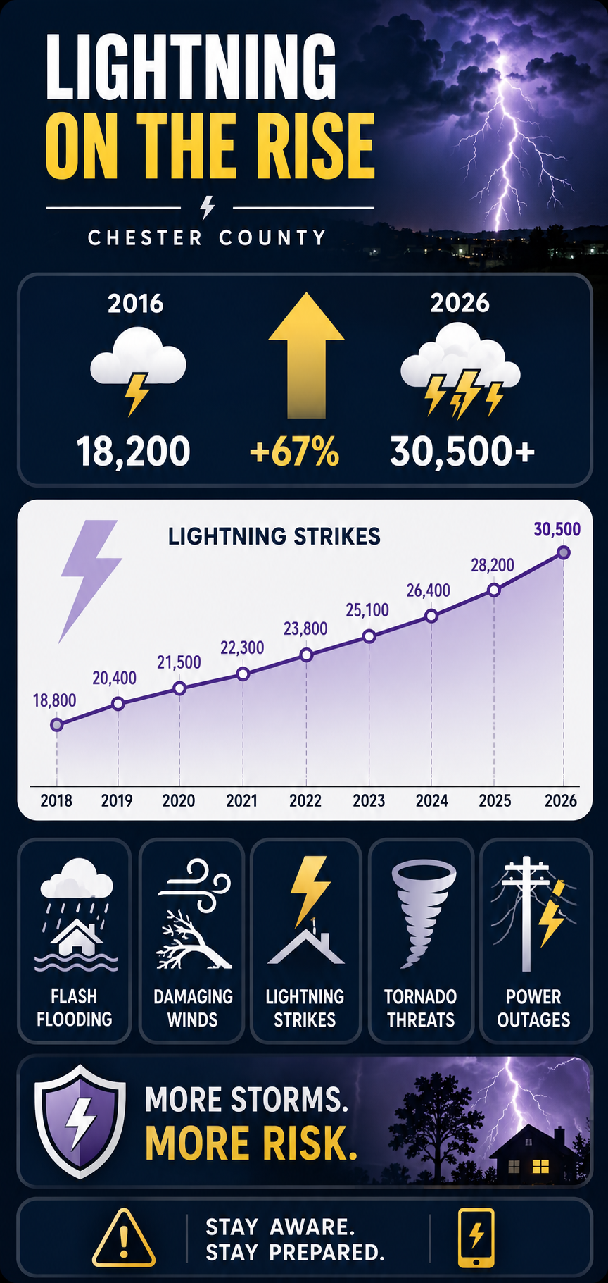
Over the past decade, the number of lightning strikes in Chester County, PA, has increased dramatically, rising from approximately 18,200 in 2016 to more than 30,500 in 2026.
During the peak of the September 1 storm, Chester County was bombarded by thousands of lightning strikes. The broader storm line was averaging more than 400 lightning strikes every 15 minutes as it moved through the region.
September 1, 2026
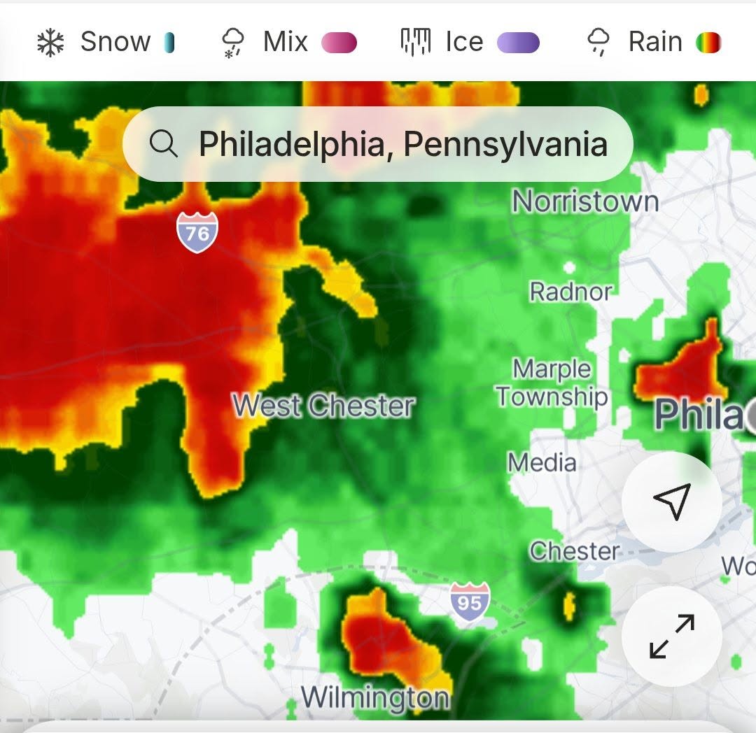
The numbers become much more tangible when a major storm moves through your own neighborhood.
On Tuesday night, September 1, 2026, the Philadelphia region was hit by a major outbreak of severe thunderstorms.
A dangerous combination of high heat, intense humidity, and a passing cold front helped generate widespread severe weather across the Delaware Valley.
The storm system produced:
⚡ Frequent lightning
🌧️ Torrential rainfall
🌊 Flash flooding
🌬️ Destructive straight-line winds
🌪️ Tornado warnings
🔌 Widespread power outages
The National Weather Service issued repeated severe-weather warnings as the storm line moved across southeastern Pennsylvania, northern Delaware, and southern New Jersey.
Chester County was among the hardest-hit areas in southeastern Pennsylvania.
Lightning Strikes Twice
During the peak of the September 1 storm, Chester County was bombarded by thousands of lightning strikes.
The broader storm line was averaging:
400+ strikes
every 15 minutes
during the storm’s peak intensity.
The electrical activity was accompanied by destructive winds, heavy rainfall, flooding, emergency responses, structural damage, and widespread grid failures.
This is what a lightning trend looks like when it stops being a number on a chart and starts happening over your house.
Local Damage and Emergency Responses
The continuous cloud-to-ground lightning triggered emergency responses throughout Chester County.
Valley Township
Emergency crews responded to reports of a residential home struck by lightning in the 100 block of South Park Avenue.
The strike reportedly split a massive tree, sending it into the structure.
West Goshen
Fire units responded to the 300 block of Mackenzie Drive after a house was reportedly struck directly by lightning.
The strike generated heavy smoke in the basement.
Grid Destruction
Lightning was only one component of the electrical and infrastructure damage.
The storm also produced destructive straight-line wind gusts reportedly reaching up to 80 mph.
Trees and utility poles were damaged or knocked down, contributing to widespread power failures.
At one point, Chester County experienced more than 29,000 concurrent power outages, making it the hardest-hit county in southeastern Pennsylvania.
The Storm Was Bigger Than Lightning
Lightning gets the attention because we can see it.
But lightning is only one expression of the energy contained within a severe thunderstorm.
The same atmospheric system can produce: electrical discharg, extreme rainfall, straight-line winds, tornadoes, hail, flash flooding, grid failures.
The atmosphere is continually transforming and redistributing energy. Solar energy heats the surface. Heat drives evaporation. Evaporation transfers energy into water vapor. Water vapor rises. Condensation releases latent heat. That released energy strengthens convection. Convection builds thunderstorms. Inside those storms, electrical charges separate.
And eventually—
FLASH!
The energy reaches the ground.
A Shocking Ten-Year Trend
The most striking feature of the lightning data is not one enormous year.
It is the persistent upward movement from 18,800 in 2018 to 30,500 so far in 2026. The trend moves steadily upward. Over the period shown, annual lightning strikes increased by approximately 62%.
What Does Climate Change Have to Do With It?
Climate change changes the atmospheric background in which thunderstorms develop.
A warmer atmosphere can contain more water vapor.
More water vapor means more latent energy.
Greater heat and moisture can contribute to greater atmospheric instability.
And when the atmospheric ingredients come together, thunderstorms can become more intense.
That creates the potential for more extreme manifestations of atmospheric energy—including lightning.
The important question is therefore not simply:
“Did climate change cause last night’s lightning?”
The more important question is:
“How is a warmer and increasingly moisture-loaded atmosphere changing the conditions under which severe thunderstorms develop?”
That is the climate question.
Chester County, It’s Shocking
Global warming is often discussed in terms of fractions of a degree.
1°C.
1.5°C.
2°C.
Those numbers can seem distant and abstract.
But the atmosphere translates temperature changes into physical processes.
Heat becomes moisture.
Moisture becomes instability.
Instability becomes convection.
Convection becomes thunderstorms.
Thunderstorms become lightning, torrential rain, destructive winds, flooding, and power failures.
And sometimes that energy comes directly into your neighborhood.
30,500 lightning strikes in 2026.
More than 29,000 simultaneous power outages.
80-mph wind gusts.
Flooding.
Damaged homes.
Fallen trees.
Emergency responders racing into the night.
This is how climate energy becomes local.
It doesn’t remain on a graph.
It hits the ground.
And in Chester County—
it’s shocking.